Welcome to the University of Lethbridge
  • Library
  • Directory
  • Intranet
  • MyExperience
  • Webmail
  • Bridge
  • Moodle
Study here Give
U of L Campus Master Plan
Close
  • About
  • Planning History
    • Development Plan (1969)
    • Phase IV Report (1990)
    • Plan Review (1993)
    • Master Plan Report (2000)
    • Precinct Plan (2000)
    • Expansion Plan (2001)
    • Archival Gallery
  • Planning Process
    • Project Initiation
    • Planning Phases
  • UCMP (2012)
  • Contact
  • Library
  • Directory
  • Intranet
  • MyExperience
  • Webmail
  • Bridge
  • Moodle
Study here Give
Planning History
  • Development Plan (1969)
    • The Vision
    • Planning Models
    • Objectives
    • Goals
    • Site Parameters
      • Environmental Data
      • Topography and Vegative Cover
      • Soils
      • Prairie Landscape
    • Planning Objectives
    • The Development Plan
      • Land Use
      • Circulation
      • Form and Massing
      • Landscape
      • Academic Area
    • Implementation
    • Accolades
  • Phase IV Report (1990)
    • Design Goals
    • Long Range Plan
    • Analysis of Plan Options
  • Plan Review (1993)
    • Development Guidelines
    • Campus Development 1969-1993
    • Current Issues
    • Strategy for Future Development
    • Recommended Development
      • Site A - South Coulee
      • Site B - West Ridge
      • Site C - North University Hall
  • Master Plan Report (2000)
    • Modified Anderson Hall Model
    • Key Development Guidelines
    • Site Development Strategy
    • Master Plan Directions
      • Site Plan
      • Site Topography
      • Landscape Plan
      • Pedestrian Routes
      • Vehicular Routes
      • Future Projects
      • Precinct Plans
  • Precinct Plan (2000)
    • Master Plan Report (2000)
    • Precinct Plans
    • Conceptual Design Guidelines
    • Project/Master Plan Reviews
    • Life Sciences Building
  • Expansion Plan (2001)
    • Key Findings
    • Campus Vision
    • Campus Design Concepts
      • Phase 1
      • Phase 2
  • Archival Gallery

Landscape

To maintain the concept of the prairie landscape, the upper levels of the university are left in a natural open field-like landscape treatment. Playing fields will be terraced, and parking lots both terraced and bermed, so that the automobile is kept out of sight and wind and drifting snow are controlled. The coulees adjacent to the academic area, however, will be planted to provide shelter and shaded relief from the exposure of the open fields.

Exerpted from pages 28 of the Development Plan, 1969.

Landscape Analysis and Development Guidelines

A separate analysis of our unique landscape was prepared in order to develop landscape guidelines in 1969 through Erickson-Massey Architects by the landscape architecture and urban design firm Man Taylor Muret Ltd. of Calgary-Winnipeg.

Image

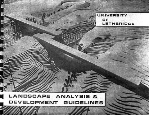
See the original Landscape Analysis Development Guidelines, 1969 document.

Students

  • Academic calendar
  • Student Enrolment and Registrar Services
  • Student opportunities
  • Student services
  • Study here

Information for

  • Alumni
  • Donors
  • Visitors and community

Campus

  • Careers at uLethbridge
  • Events
  • Faculty and staff intranet
  • Maps and tours
  • News
Visit the University of Lethbridge Homepage
  • Lethbridge, Alberta, Canada
  • Contact us
  • Calgary Campus
  • Faculty and staff directory

The University is located on traditional Blackfoot Confederacy territory. We honour the Blackfoot people and their traditional ways of knowing in caring for this land, as well as all Aboriginal peoples who have helped shape and continue to strengthen our University community.

©2025 University of Lethbridge | Terms of use