Welcome to the University of Lethbridge
  • Library
  • Directory
  • Intranet
  • MyExperience
  • Webmail
  • Bridge
  • Moodle
Study here Give
U of L Campus Master Plan
Close
  • About
  • Planning History
    • Development Plan (1969)
    • Phase IV Report (1990)
    • Plan Review (1993)
    • Master Plan Report (2000)
    • Precinct Plan (2000)
    • Expansion Plan (2001)
    • Archival Gallery
  • Planning Process
    • Project Initiation
    • Planning Phases
  • UCMP (2012)
  • Contact
  • Library
  • Directory
  • Intranet
  • MyExperience
  • Webmail
  • Bridge
  • Moodle
Study here Give
Planning History
  • Development Plan (1969)
    • The Vision
    • Planning Models
    • Objectives
    • Goals
    • Site Parameters
      • Environmental Data
      • Topography and Vegative Cover
      • Soils
      • Prairie Landscape
    • Planning Objectives
    • The Development Plan
      • Land Use
      • Circulation
      • Form and Massing
      • Landscape
      • Academic Area
    • Implementation
    • Accolades
  • Phase IV Report (1990)
    • Design Goals
    • Long Range Plan
    • Analysis of Plan Options
  • Plan Review (1993)
    • Development Guidelines
    • Campus Development 1969-1993
    • Current Issues
    • Strategy for Future Development
    • Recommended Development
      • Site A - South Coulee
      • Site B - West Ridge
      • Site C - North University Hall
  • Master Plan Report (2000)
    • Modified Anderson Hall Model
    • Key Development Guidelines
    • Site Development Strategy
    • Master Plan Directions
      • Site Plan
      • Site Topography
      • Landscape Plan
      • Pedestrian Routes
      • Vehicular Routes
      • Future Projects
      • Precinct Plans
  • Precinct Plan (2000)
    • Master Plan Report (2000)
    • Precinct Plans
    • Conceptual Design Guidelines
    • Project/Master Plan Reviews
    • Life Sciences Building
  • Expansion Plan (2001)
    • Key Findings
    • Campus Vision
    • Campus Design Concepts
      • Phase 1
      • Phase 2
  • Archival Gallery

Prairie Landscape

The praire landscape is a distillation of the multitude of various elements that compose other landscapes into the basic elements of earth and sky. Objects caught between these vast and simple elements appear trivial unless emerging intrinsicly from one or the other or unless reflecting in generosity of size the prairie scale.

Thus, the cluster of farm buildings, widely spaced across sections of land, become isolated accents in the sweeping folds of the prairie: or the group of elevators rising out of the small town at the railway stop become majestic focal points for vast areas of land and sky. But build a subdivision over the subtle folds of the land and the prairies is destroyed. The grades are too gentle, the countours too soft, to survive the onslaught of an endless scattering of buildings. Without breathing space, vast quantities of it between clusters of buildings, the prairie dies.

Reduced to elementals – the sky as space, the earth as form, every aspect of these becomes poignantly clear. The pattern of clouds, of plowed fields or river coulees, each vividly conveys a meaning. Colour is the sky under storm, wheat stubble in the snow, a newly turned earth. Each set of colours unveils meaning.

Image

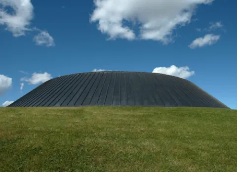
Thus, to maintain harmony with the land, one must submit to its rules. One must use space generously or not at all. Buildings must grow out of the ground, clustered with other buildings or trees, but never sit blatantly on top of the ground. Forms must be simple and geometrically concise, as elaborate forms and fussy detail show as weakness. As the geometry of the section measures out the landscape, one must work with an equally clear geometry or appear indecisive. Just as the prairie landscape has been reduced to essentials, so must its buildings be elemental.

The light of the prairies has the clarity of the land forms. The moods are definite, indisputable and range over the base extent of the sky. The light nakedly exposes the land forms and if the forms are weak, extinguishes them. Surfaces become significant, as the reflectors of light, the envelope of form, the source of pattern and color.

- - -

A planning report entitled: Landscape Analysis & Development Guidelines was developed in 1969 to specifically address appropriate means to maintain a sensitivity to our native ecology and development in the coulee and plateau areas.

Students

  • Academic calendar
  • Student Enrolment and Registrar Services
  • Student opportunities
  • Student services
  • Study here

Information for

  • Alumni
  • Donors
  • Visitors and community

Campus

  • Careers at uLethbridge
  • Events
  • Faculty and staff intranet
  • Maps and tours
  • News
Visit the University of Lethbridge Homepage
  • Lethbridge, Alberta, Canada
  • Contact us
  • Calgary Campus
  • Faculty and staff directory

The University is located on traditional Blackfoot Confederacy territory. We honour the Blackfoot people and their traditional ways of knowing in caring for this land, as well as all Aboriginal peoples who have helped shape and continue to strengthen our University community.

©2025 University of Lethbridge | Terms of use