WHIS&T 2011
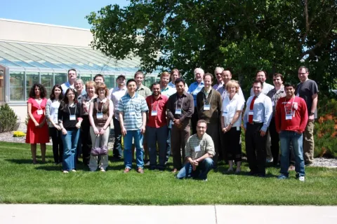
Image
Agenda:
Our Annual AMETHYST Workshop on Hyperspectral Imaging Science & Technology (WHIS&T 2011) was held on June 21st, 2011 at the Agriculture and Agri-Food Centre Lethbridge Research Centre, and featured presentations from three guest speakers: Dr. Edward Cloutis (University of Winnipeg), Dr. Harold Zwick (MDA) and Dr. Benoit Rivard (University of Alberta).
In addition, a closed session (which included only AMETHYST trainees) was held on June 28th, and featured a data extraction and manipulation tutorial in the morning, and a tour of the CCBN MRI facility in the afternoon.
AMETHYST-WHIS&T2011-Agenda-June21,2011
Registration:
Registration for this event has closed.
Guest Speaker Presentations:
Edward Cloutis:
“Hyperspectral Applications in Planetary Geology, Forestry, and Security”
Abstract:
Hyperspectral remote sensing is applicable to a wide range of disciplines. Technology developed initially for planetary exploration is being applied to diverse Earth-bound issues such as monitoring the health of forests, analysis of paintings and other cultural artifacts for their conservation, attribution, and fraud detection. It is also finding new applications in the search for life on Mars.
In terms of analysis of cultural artifacts we are using hyperspectral imaging to non-destructively determine the composition of pigments used to produce a particular painting (which helps to determine its authenticity or whether it has been modified or altered, as different pigments became available at different times in the past). With infrared imaging we are able to view underdrawings created by an artist in preparation for painting and such information is useful for attribution and connoisseurship. Our work on hyperspectral analysis of marble statuary involves determining the nature of any surface patinas or weathering products to aid in preservation. We are also starting to explore the use of hyperspectral imaging as a possible non-destructive technique for determining carbon isotopic ratios in marble as a guide to determining marble source regions.
Our work involving hyperspectral remote sensing for Mars exploration is focusing on determining the presence of minerals indicative of habitable environments, such as carbonates and clays. We are also embarking on a study of the spectral properties of airborne Martian dust as a probe of planetary surface geology. This work will be extended to terrestrial dust in order to better understand the effects of airborne dust on the Earth's climate and radiation budget.
Harold Zwick:
“MDA and Hyperspectral Imagery: an Industrial view”
Abstract:
The presentation will first provide an introduction to MacDonald, Dettwiler and Associates Ltd. and its operating divisions. The range of ground-based and space-based information solutions will be highlighted that offer improved decision making and operational performance of business and government organizations worldwide. The presentation will also review the company’s experience with hyperspectral technologies, applications and systems.
Benoit Rivard:
“Hyperspectral Sensing in Support of Mineral Exploration in Northern Latitude Remote Regions: Examples from the Cape Smith Nickel Belt, Canada”
B.Rivard1, D. Rogge1, J. Feng1, B. Grant2, J. Pardie2
1University of Alberta, Edmonton, Alberta, Canada;
2Goldbrook Ventures, Vancouver, Canada
Abstract:
Regional geologic mapping in the Arctic is time intensive and costly, primarily owing to poor accessibility, but it is essential for subsequent geologic investigations and to guide mineral exploration activities. Along with established geophysical exploration technologies (e.g. magnetic and radiometric surveys), hyperspectral imaging is a promising avenue to facilitate detailed continuous regional mapping in the Arctic, if issues such as low illumination and lichen cover on bedrock can be addressed. This study investigates AISA optical airborne hyperspectral imagery (~2500 km2) acquired over the Proterozoic Cape Smith greenstone belt of northern Quebec (Nunavik), Canada that is host to Nickel-Cu-(PGE) mineralization. The objective is to demonstrate the capability of producing detailed maps from hyperspectral imagery to highlight ultramafic rock units associated with mineralization in the presence of lichen coatings. Through calibration, field spectra, geometric processing and a series of normalized multi-band ratios, valuable mineralogical information was captured from airborne imaging spectroscopy despite extensive cover by rock encrusting lichen. It will also be shown how predictive map distributions emulated detailed ground mapping conducted for a subset of the region as part of on-going mineral exploration efforts.
This workshop was funding by the TECTERRA GEO-Expert Training Program.
Please see their site for more detailes.