Remote Sensing (MSc)
Length of program
Part-time: 48 months
Mode of delivery
Program consists of:
Campus
Intake
Related programs
Program description
The MSc in Remote Sensing enables students to develop advanced research skills in remote sensing. The objective of the program is to accommodate students interested in studying aspects of remote sensing that are not contained in the geographical research domain. These students are often interested in the physics of remote sensing, radiative transfer, and atmospheric remote sensing, or have backgrounds outside of the discipline of geography.
The MSc in Remote Sensing is a 24 month research-based program. Students are required to take between two to six courses at a graduate level and complete a thesis. For those who are currently employed in the remote sensing field and are looking for opportunities to upgrade their skills, we also offer part-time (48 months) graduate study option.
The program focuses on developing scientific research skills required in the rising scientific, academic, and industrial market for students with advanced training in remote sensing. Crucial learning outcomes of this program are research skills, scientific literacy, and the ability to conduct original independent scientific research. On successful completion of the program, students will acquire transferable professional skills with the largest group of remote sensing scientists in Canada.
This program is seeking students that have physics in their undergraduate training. If students have come through uLethbridge BSc in Remote Sensing (or its academic equivalent) then they will have sufficient understanding of physical processes that govern remote sensing. More traditionally trained geography students who want advanced education in the applications area of remote sensing would be better served by our MSc in Geography.
Learning outcomes
The investigation of a Remote Sensing topic requires a range of learning outcomes, skills, and competencies including analysis and synthesis of ideas, empirical investigations, construction and articulation of arguments, and writing skills. The program-level learning outcomes include the following:
- Understand the context and complexity of Earth observation.
- Develop competencies in laboratory techniques required for observing and quantifying objects and patterns found in the Earth, atmosphere, ocean, and space.
- Become skilled users of modern imaging technologies for solving geographical problems.
- Effectively use the tools of remote sensing to map and monitor various aspects of Earth science.
- Gather, analyze, and interpret geospatial data collected using remote sensing tools.
- Perform problem solving in academic, government, and industrial environments in remote sensing.
- Work effectively as a team member.
- Organize and pursue a scientific or industrial research project in remote sensing.
- Write theses and reports to a professional standard, equivalent to that of publishable papers in the field of remote sensing.
- Derive and apply solutions from knowledge of sciences and technology relevant to remote sensing.
- Deliver high quality oral presentations of research results related to remote sensing.
Finding a supervisor
Students are required to secure a potential supervisor prior to submitting an application for this program.
Chris Hopkinson
Craig Coburn
Derek Peddle
Laura Chasmer
Additional supervisors may be available. Visit Search Supervisors webpage or contact the School of Graduate Studies.
Career pathways
This degree will prepare graduates to compete for employment opportunities focused on imaging science and technology, a multi-billion dollar industry. The Canadian remote sensing industry has grown at a rapid pace over the last few decades. Canada is a world-leader in the science of remote sensing, with a diversity of industrial, environmental, sovereignty, security, and technological needs for advanced technologies and highly trained persons in the science of remote sensing.
Lethbridge has a thriving remote sensing technology sector. This includes agencies like Planet Labs (Planet), Farmer’s Edge, and the Alberta Terrestrial Imaging Centre. The University of Lethbridge also hosts a ground receiving station for the SPOT imaging satellite system and hosts sensor and calibration equipment that has an international reputation.
Additional information
The researchers in remote sensing at the University of Lethbridge are among the best equipped in the country with respect to equipment and computer resources. We have three dedicated laboratory facilities including:
- a LiDAR facility;
- a remote sensing laboratory with space for student projects and field equipment deployment; and
- Canada’s only remote sensing calibration dark room facility.
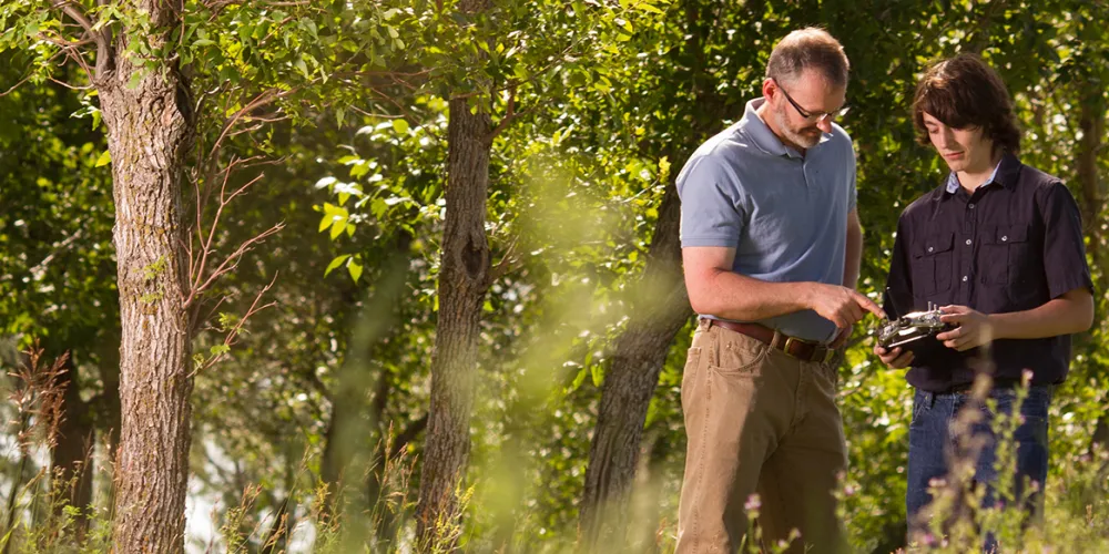
The uLethbridge has ten hyperspectral field spectrometers, integrating spheres, differential GPS, hydro-meteorological stations, airborne and UAV systems, and Canada’s only field goniometer system. There is ample student research space. Students will also have access to the U of L’s West Castle Field Research Station where Professors Hopkinson and Chasmer have an active research program.