
Field Spectroscopy
Measuring How the Environment Interacts with Light
i4Geo’s field spectroscopy capabilities support high-resolution measurement of spectral reflectance across a wide range of wavelengths.
Using portable field spectroradiometers, our team can collect spectral measurements of vegetation, soils, water, rocks, and other surfaces to support remote sensing research, sensor validation, environmental monitoring, and the development of spectral reference datasets.
Discuss a Field Spectroscopy Project
Our Field Spectroscopy Equipment
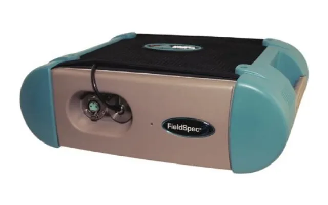
ASD FieldSpec 3 Spectroradiometer
The ASD FieldSpec 3 is a portable field spectroradiometer designed for high-resolution spectral measurements across the visible, near-infrared, and shortwave-infrared regions of the electromagnetic spectrum.
It enables detailed characterization of the spectral properties of vegetation, soils, geological materials, water, and other environmental targets.
Applications:
Vegetation spectroscopy • Soil and geological studies • Spectral libraries • Remote sensing validation • Environmental research
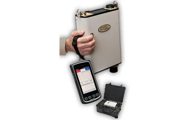
SVC HR-1024 Field Spectroradiometer
The SVC HR-1024 supports portable field measurement of spectral reflectance for environmental and remote sensing applications.
Its field-based operation enables spectral observations to be collected directly from targets and subsequently integrated with imagery and other geospatial datasets.
Applications:
Surface reflectance • Vegetation analysis • Geological characterization • Ground validation • Spectral library development
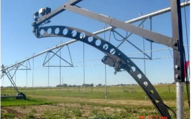
University of Lethbridge Goniometer System 2 (ULGS-2)
Advanced Multi-Angular BRDF Measurement — The ULGS-2 is a specialized, computer-controlled field spectrogoniometer developed at the University of Lethbridge for measuring the directional reflectance properties of natural and artificial surfaces.
By collecting spectral observations across multiple viewing geometries, the system enables detailed characterization of Bidirectional Reflectance Distribution Function (BRDF) and supports advanced research into how surface reflectance varies with observation angle.
Applications:
BRDF measurement • Multi-angular spectroscopy • Vegetation & canopy research • Surface reflectance characterization • Remote sensing calibration & validation
What We Can Measure
This can be a really attractive visual strip rather than another paragraph:
VEGETATION | SOIL | ROCKS & MINERALS | WATER | BUILT SURFACES | REFERENCE TARGETS
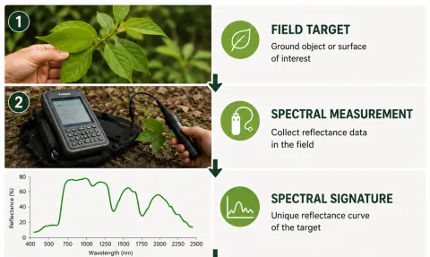
Spectral measurements provide a quantitative record of how different materials reflect electromagnetic energy, helping distinguish surfaces that may appear similar in conventional imagery.
Connecting Ground Measurements with Imagery
Field spectroscopy provides detailed measurements at the target level that can be integrated with multispectral and hyperspectral imagery collected from RPAS, airborne, and satellite platforms.
i4Geo can combine field spectral observations with geospatial and remote sensing datasets to support image interpretation, classification, calibration and validation, and environmental analysis.