Subsurface Sensing
See Beyond the Surface
i4Geo’s subsurface sensing capabilities support non-invasive investigation and mapping of features below the ground surface.
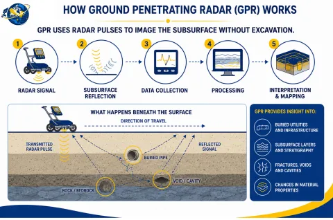
Using Ground Penetrating Radar (GPR), our team can collect and analyze subsurface information to support research and collaborative projects in areas such as environmental studies, infrastructure assessment, geological investigation, and subsurface mapping.
Ground Penetrating Radar (GPR) is a non-destructive geophysical technique that transmits electromagnetic signals into the ground and records reflections produced by changes in subsurface materials and buried objects. The resulting data can be used to investigate subsurface structures without excavation.
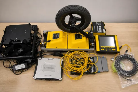
Sensors & Software SPIDAR® Multi-Channel GPR System
The Sensors & Software SPIDAR® system provides i4Geo with configurable, multi-channel Ground Penetrating Radar (GPR) capabilities for non-invasive subsurface investigation.
SPIDAR enables multiple GPR units to operate as an integrated system, allowing different radar configurations to be used according to project objectives and field conditions. The system can incorporate positioning information from an odometer and GPS to support spatially referenced subsurface data collection.
Key Capabilities:
Multi-Channel GPR — Network multiple GPR units for coordinated subsurface data acquisition.
Flexible Survey Configuration — Configure the system for different survey objectives and subsurface investigation requirements.
Positioned Data Collection — Integrate odometer and GPS positioning with GPR measurements.
Large-Area Surveying — Collect multiple parallel lines of GPR data during a single pass.