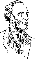
 John Palliser's Exploration
of the Canadian RockiesJohn Palliser's Exploration
of the Canadian Rockies
John Palliser's Exploration
of the Canadian RockiesJohn Palliser's Exploration
of the Canadian RockiesEditor's note:- In 1978 with the help from the Explorations Programme of the Canada Council I researched, retraced and documented the route followed by Thomas Blakiston of the Palliser Expedition in 1858 through the Canadian Rockies. Blakiston did a wonderful job describing everything he saw and there was little trouble figuring out his route. In 1983 with the support of the Alberta Historical Resources Foundation I followed James Hector's route of exploration and was thrilled to find his landscape descriptions easy follow.
It was always my desire to follow John Palliser's route, the last of the three August 1858 thrusts into the mountains but each time I read his route description in the Palliser Papers I came away confused.
Which route did Palliser travel? - the controversy
Please note: Pictures found in this text are based on the assumption that Palliser did indeed travel over the Elk Pass and not the North Kananaskis Pass as has until now been the accepted route.
August 17, 1858
The scenery around (Old Bow Fort) is wild
and beautiful. Its site is at the base of the Rocky Mountains, which tower
above it to the height Of 3,000 or 4,000 feet, the white summits of which,
from a sprinkling of snow that had recently fallen, formed a pretty contrast
with the dense sombre forests at their feet. The Bow
River![]() flows by
in all the wildness of mountain character, foaming at intervals over ledges
of rock in its valley, and then rushing onwards between high banks, clad
with luxuriant vegetation.
flows by
in all the wildness of mountain character, foaming at intervals over ledges
of rock in its valley, and then rushing onwards between high banks, clad
with luxuriant vegetation.
Old Bow Fort
![]() was ultimately abandoned.
by the Company, owing to the expenses involved in keeping a sufficient staff
of men for its protection. The barter was chiefly for provisions and buffalo
robes, and very few of the fine furs were obtained, so that by the time
the goods were transported, and the few furs sent to Lake Winnipeg, very
little profit resulted. Besides frequent attacks were made on them by the
Blackfeet, and several of the Company's servants lost their lives in defending
the establishment.
was ultimately abandoned.
by the Company, owing to the expenses involved in keeping a sufficient staff
of men for its protection. The barter was chiefly for provisions and buffalo
robes, and very few of the fine furs were obtained, so that by the time
the goods were transported, and the few furs sent to Lake Winnipeg, very
little profit resulted. Besides frequent attacks were made on them by the
Blackfeet, and several of the Company's servants lost their lives in defending
the establishment.
August 18, 1858
At noon we had completed the preparations
for our departure and, with a party of four men and nine horses, commenced
our journey across the Rocky Mountains. Ascending the Bow River for about
five miles, we forded the stream at the distance of about
half a mile  above where the Kananaskis
River joins it.
above where the Kananaskis
River joins it.
August 19, 1858
Here I observed a very satisfactory proof that lightning in the mountains must frequently be the cause of fires, and that all forests are not destroyed by the hand of man, for we saw whole masses of forest, isolated in mountain cliffs, fallen by fire, the mountain trees burnt in places so precipitous that no human hand could ever have reached them.
August 20, 1858
Keeping almost a southerly course till noon, we arrived at a patch of prairie land, which offered good feeding for our horses, and, as such places are rare, we encamped for dinner...About four miles south of this place, there is another similar patch of sward, and at its western extremity the wild and beautiful Kananaskis river leaps over a ledge of rock in its valley from the height of 20 feet, and rushes on its way through a dense forest of pines.
Two very conspicuous mountains at a distance
of about 12 miles to the south of us flank the height
of land![]() across which we shall have to pass
to gain the western side of the watershed. From a lake at the base of the
more southerly mountain a large tributary of the Kootanie has its source;
and after an almost due southerly course it joins the main stream near the
49 parallel of north latitude. This river is hemmed in on either side by
mountains, the sides of which rise almost perpendicularly.
across which we shall have to pass
to gain the western side of the watershed. From a lake at the base of the
more southerly mountain a large tributary of the Kootanie has its source;
and after an almost due southerly course it joins the main stream near the
49 parallel of north latitude. This river is hemmed in on either side by
mountains, the sides of which rise almost perpendicularly.
August 21, 1858
By noon we had arrived at the base of the two high mountains alluded to above...We remained here for about two hours, to take our observations. We were in a level meadow, hemmed on all sides by a dense forest of pines, which stretched far away up the mountain sides Higher up the valley is the glacier, which forms the source of the Kananaskis River. This glacier sends off the mountain sides hundreds of small streams, which, under the sun's rays, had the appearance of silver threads.
The mountain goats higher up, which looked like small white spots in slow motion, seemed to eye us as intruders. At our feet the river, which above this place spreads out into two lakes, flows through a contracted channel with great rapidity.
Crossing one
of the lakes![]() which forms part of
Kananaskis River, and continuing our course to the point where we intended
to make our ascent we came on a magnificent lake, hemmed in by mountains,
and studded by numerous islets, very thickly wooded.
which forms part of
Kananaskis River, and continuing our course to the point where we intended
to make our ascent we came on a magnificent lake, hemmed in by mountains,
and studded by numerous islets, very thickly wooded.
This lake, about 4 miles long and 11 miles wide, receives the waters from the glacier above, and is a favourite place of resort to the Kootanie Indians. They cross the height of land from the west, and go off in canoes to the islets in the lake, for the purpose of hunting the elk, an animal which seems to prefer these wooded islands to the denser forests on the shore.
While going round the edge of this sheet of water, where the fallen timber greatly embarrassed us, one of our horses, strangely enough, adopted the other alternative of swimming across the lake. This effort of intelligence caused us serious misfortune and dismay, as his pack contained our only luxuries, our tea, our sugar, and our bedding.
For about a mile from this lake our course was difficult to the horses, on account of the broken rocky character of the country. In some places large blocks of the limestone, which composes the mountains in this part, were lying all broken and heaped in a singularly artificial manner.
We camped close to the Kananaskis River, at the base of the most northerly of the two high mountains noticed above. Here the river was flowing rapidly over a steep incline to the lake we had left, and above us the lofty cone-shaped mountain reared its apex to a great height, the passing clouds sometimes hiding its summit from our view
We [had] now arrived at the
termination of the lateral valley,  through which
the Kananaskis River follows to join the Bow River; the only serious
obstacle we have met with arises from fallen timber, otherwise the course
is practicable enough and almost devoid of swamp.
through which
the Kananaskis River follows to join the Bow River; the only serious
obstacle we have met with arises from fallen timber, otherwise the course
is practicable enough and almost devoid of swamp.
August 22, 1858
We started
 from our encampment at half-past seven,
and travelled till 10 a.m., when we reached the edge of the pine woods at
the base of the height of land, took an observation for longitude, 115°
27', then breakfasted, and at noon took observation for latitude, 50°
37' 40". Started again at half-past twelve on our ascent, which we
found much easier than we had anticipated." At
two
from our encampment at half-past seven,
and travelled till 10 a.m., when we reached the edge of the pine woods at
the base of the height of land, took an observation for longitude, 115°
27', then breakfasted, and at noon took observation for latitude, 50°
37' 40". Started again at half-past twelve on our ascent, which we
found much easier than we had anticipated." At
two ![]() we had nearly reached the height of land.
we had nearly reached the height of land.
We then stopped at a spring to rest the horses,
after which we completed our ascent in a few minutes,
having gained the height. Our course
was circuitous, owing to the rocky nature of the summit level, which was
not altogether devoid of timber
Our course
was circuitous, owing to the rocky nature of the summit level, which was
not altogether devoid of timber
At about half-past four p.m. we
camped at a small lake,![]() about half an acre in
area, where there was some tolerable grass for the horses. From this lake
flow the first waters we had seen which descend to the Pacific Ocean.
about half an acre in
area, where there was some tolerable grass for the horses. From this lake
flow the first waters we had seen which descend to the Pacific Ocean.
With these waters we supplied our tea kettle,
while our scanty supper of tough elk meat was boiling in the waters of the
Saskatchewan. The altitude of the summit level was by barometric measurement 731 feet above the valley of
the Kananaskis River.
level was by barometric measurement 731 feet above the valley of
the Kananaskis River.
Very little vegetation appears along the summit of the watershed, which is overspread with masses of stones and rocks, and the only animal which we have seen is the siffleur, whose shrill whistle we heard for the first time close to our encampment of to night.
Towards dark the summits of the mountains became wrapped in misty clouds; this, combined with our proximity to the glaciers on either side, and the scarcity of wood for our camp fire, caused us to pass a chill and uncomfortable night.
August 23, 1858
Started after breakfast, rode along the southern border of our little tea-kettle lake, and commenced our descent of the western slope of the Rocky Mountains. Following the stream that issued from the lake we observed it grow larger and larger as it received innumerable little tributaries, until it at last became a broad and rapid, although shallow, stream, and assumed the dimensions of a considerable river.
The first
300 ![]() feet of our descent was very steep for
the horses, as well as rocky and covered with loose shingle,but as we descended
the valley the slope became less formidable; at
the base of this slope
feet of our descent was very steep for
the horses, as well as rocky and covered with loose shingle,but as we descended
the valley the slope became less formidable; at
the base of this slope![]() in the valley
of this river (which the men ever afterwards called Palliser's River, to
distinguish it from the other branch of the Kootanie River)...
in the valley
of this river (which the men ever afterwards called Palliser's River, to
distinguish it from the other branch of the Kootanie River)...
Editor's note:- At this point in Professor Irene Spry's edited Palliser Papers, things get very confusing.
Are the words in brackets above John Palliser's or hers? Why are we suddenly talking about the Palliser River? Further along you will read:
Captain Palliser, accompanied by our Stoney guide, ascended one of the mountains .... Suddenly, someone else is talking.
...we took readings, which may thus be compared with those taken in the valley of the Kananaskis at the other side of the height of land...showing the valley of the western stream.465 feet lower than that on the eastern side of the height of land.
The rain was continuous up to 10.30 a.m., when a bright hot sun dispelled the clouds which hung over the mountains. We took shelter under some splendid trees on the left bank of the river till the rain passed, and then continued our course along the river valley; passing here, as on the other side of the watershed previous to our ascent, immense debachals of broken limestone.
At noon we encamped for dinner on the right bank of the river, in latitude 50° 38' 55" north. A remarkable change was observable here in the increased luxuriance of the vegetation, and also in the appearance of shrubs that we had not seen on the eastern side of the mountains.
At 1.30 P.M. we again got under weigh, and kept a S.W. by S. course till 5 p.m., when we encamped for the night on one of the many islands in the stream.
We continued our march during the latter part of the day alternately along either side of the stream) crossing the river frequently, and for the sake of convenience sometimes riding in the river itself, in order to avoid the fallen timber. Its valley is of great breadth, and the mountains which form its sides retire to a good distance on either hand.
Continue following Palliser through the Rockies
Back to John Palliser Timeline
Back to Following Historic Trails Index